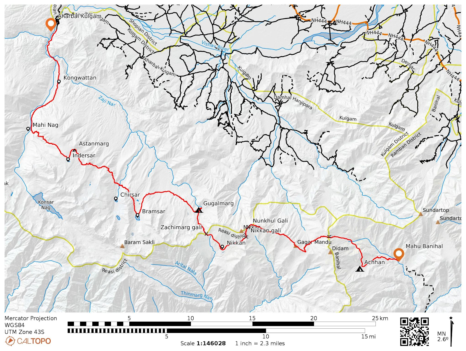
Astanmandu Baihk and Hiramarg trek
Exploring SE Extremity of Valley
By the SE extremity, i mean the area between Banihal range from Doru Verinag
upto Sinthan pass. There is so much of potential in this sub 3500m
regions of Kokernag, Daksum, Garol, Doru Verinag and surrounding
regions.
These regions are separated by the long spurs of main mountain range
surrounding the valley from SE.
|
|
Map showing the surrounding hills and passes. |

Sunday, 08-01-2023
As usual, we left our homes early in the morning towards the hamlet of Matti
in the Kokernag tehsil of Anantnag district. The hamlet is at an elevation of
2200m and we started our hike towards Hiramarg Baihk which was at an elevation
of 3300m. The ascent was inclined from the starting and the route
winding through the dense forests mainly Kail trees. We reached to our first
marked location that is Matti gali after covering 4.5kms. Matti gali is a
2900m pass connecting Mati hamlet with Mantar valley, Gorankhal Daksum.

|
| Matti Gali |
From the gali, we moved towards south, traversed the ridge line for some more
kms and got a view of hill which we had to climb in order to reach Hiramarg.
Due to the snow, the terrain was covered and we couldn’t locate the actual
trail going upwards and started to climb on our own, making way through deep
snow.

|
| Hiramarg |
It was a 300m steep and slippery climb upto the Hiramarg baihk. It was a soul
satisfying climb. The green foliage, dense forest, freshly alpine advent, our
hearts got filled with happiness.
Finally we were at Hiramarg baihk which gave us a amazing view of surrounding
hills and high passes, Sinthan pass from the east and Banihal pass from the
west.
From Hiramarg, we decided to go further beyond towards the Astanmandu top
which was only about 2kms far away. But we had to move through deep snow which
was almost upto our knees. It also started snowing but there was a lone hut at
the top of Astanmandu. We made some fire there, had lunch and took some
rest/nap as well.

|
|
Enroute Astanmandu |
Finally at 3pm we started to move back to Mati hamlet. While descending we
chose the other way along the gully, which actually is not the route but due
to snow it was possible to descend through it.
At 5pm we were back at Mati and moved back to our homes.
Note: Carry enough water with you as there is not any source from the Mati
gali.
Starting point . Matti hamlet
Total ascent: 1545m
Total distance: 18kms (to and fro)
Difficulty level: Medium to difficult
Route details: trail not clear from Mati Gali
Checkout my Instagram story highlights named Hiramarg for more visuals.

|
| Myself at Hiramarg. |

|
| Making water at Astanmandu |

|
| View from Hiramarg towards west. |


|
| Enroute to Astanmandu |

Comments
Post a Comment