Posts

Showing posts with the label Peaks of Kashmir

Tatakooti Peak (4750m) | First Civilian summit | Sept 2022

Image
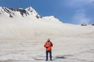
JKMAC Tatakooti Expedition - Sept 2022 Team JKMAC at the summit A nine-member team of JKMAC summited the Tatakooti peak of Pir Panjal Range, marking the third successful summit of the peak. Distance Covered : 37.57 km  Highest altitude : 4750 m (garmin) Team leaders : Mr Gh. Mohammad (Gullu) and Mr Arashid Majid. Members : Gullu, Arashid Majid Taous Baba, Haziq Beigh, Zeeshan Mushtaq, Mudasir Bashir Shah, Khursheed Beigh,Ahsan Mohsin and Tanveer Dar. A brief history: Tatakooti peak lies on the South Western side of the Kashmir Valley and is the highest peak of Pir Panjal Range, bounding the valley from South West. Dr Ernest Neve, a renowned mountaineer and medical missionary officer, in his book Beyond the Pir Panjal describes the peak as “ the most conspicuous and imposing of all the peaks of Pir Panjal range is undoubtedly Tatakooti peak, the pyramidal shape of which with a central notch and very steep and jagged western and northern sides, makes it look as if it might be exceed...

Sunset Peak

Image
Sunset peak     /   Ro mesh Thong (4730m)  Pir Panjal range   is a lofty basaltic mountain range bounding Kashmir valley from South. It  extends southeastward for more than 200 miles (320 km) from the Neelum (Kishanganga) River in the western  Azad Kashmir  area (administered by  Pakistan ), through southwestern  Jammu and Kashmir  union territory (administered by  India ), to the upper  Beas River  in northwestern  Himachal Pradesh  state, India. Rising sharply to an average elevation of more than 13,000 feet (4,000 metres), it separates the Jammu Hills to the south from the  Vale of Kashmir , beyond which lie the  Great Himalayas .   ( B ritannica) Sunset Peak , so named because it is the last of the tops to catch the rays of the setting sun.It is the second highest summit of Pir Panjal  range encompassing Kashmir valley. This peak has a saddle-back, and has been several times...

Summit History of Peaks of Kashmir Himalayas

Image
    Deo Masjid —June 16, 1911,  Capt. J. B. Corry, R.E., D.S.O., and Lieut. R. D. Squires, 45th Sherwood Foresters, with Asad Mir (Shikari) and L. N. Rajwali Khan, left a camp in the Surphrar Valley and reached the summit of the pass leading to Lidarwat. From the pass they turned south and ascended a peak about 14,000 ft. They descended by easy snow and scree to a col and thence followed the arete to the top of Deo Masjid. As a direct descent to the Jajimarg Valley proved impossible they returned to the col between the peaks, and descended by scree and snow to the Jajimarg Valley and thence to Sekwas.  Alpine Journal 1911 page 85   Kallatip Peak W. of Sonasar Pass (about 15,600 ft.).—1911 July 12. Mason, Corry and Squires with Rajwali Khan left a camp to the south of Sonasar Lake at 6.50 a.m. and ascended by steep snow towards Sonasar Pass till 8 a.m. and then traversed to the west and up rocks and snow till they reached the ridge dividing the valleys that...