Solo Exploration: Pir Panjal Traverse
Pir Panjal Traverse
Banihal to Aharbal
Vale of Kashmir
Kashmir, undoubtedly the most picturesque valley, is distinctive in its character and there is no parallel to it in the entire Himalayas. A plain embedded among the mountains, an elongated trough surrounded by the mountain ranges. From the North east it is surrounded by the central Himalayan range separating the valley from Ladakh region. On the South West side is the Pir Panjal, the first sub Himalayan mountain barrier separating the valley from the plains makes the first mountain rampart within the Himalayan belt. An impressive unit of mountains whose average crest level lies above 3800m above sea level. The mountains North of Kashmir are more or less a divergent assemblage of ranges (like Kajnag & Shamshabari), off-shoots and spurs from the north branch of the Central Himalayan range.
The valley is blessed with hundreds of alpine lakes, uplands (margs in local language) stunning peaks and unexplored landscapes. In December of 2021, while mapping the hiking routes on these ranges in OpenStreetMap (OSM), I planned to traverse the Pir Panjal range from Banihal to Tangmarg in a single continuous stretch but it didn’t went according to the plan and i had to end halfway at Aharbal Kulgam.
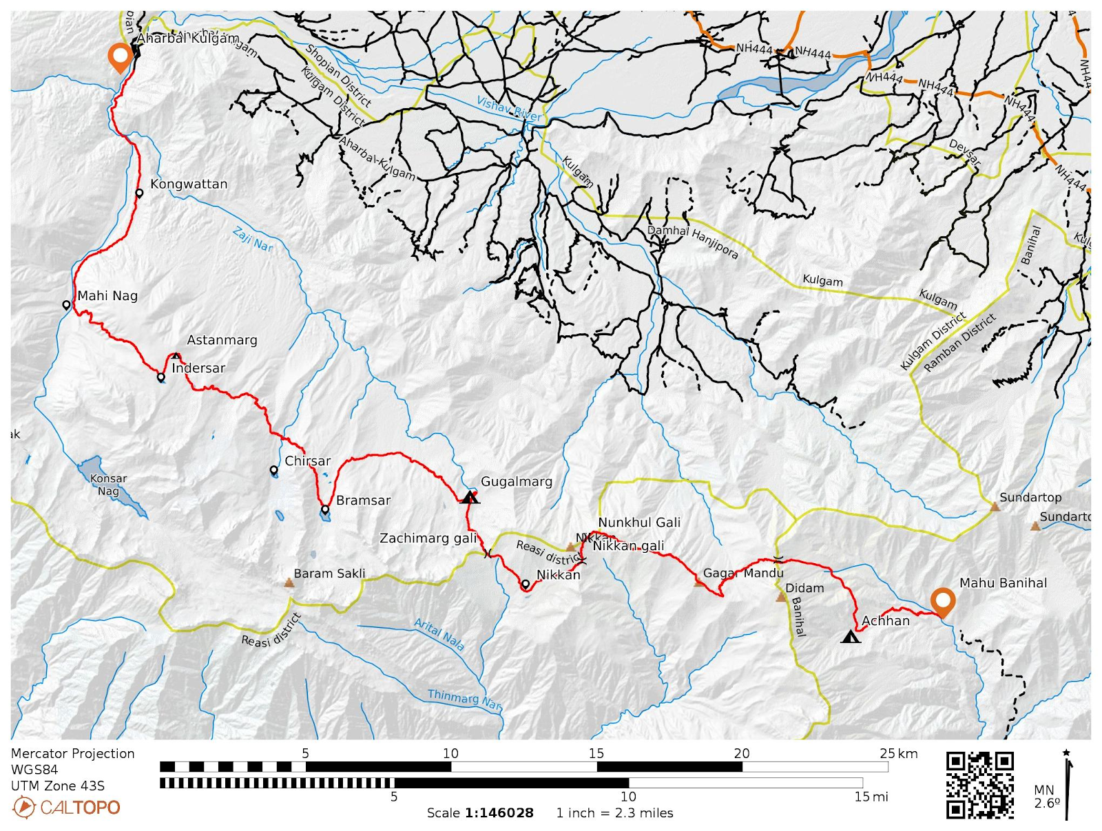
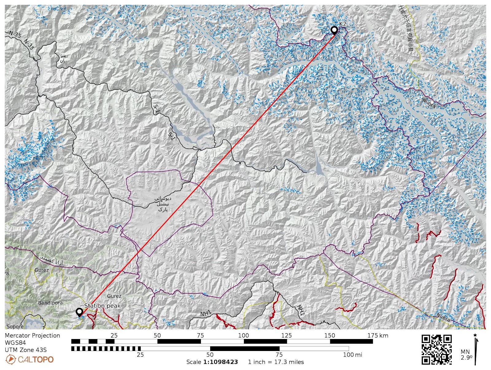
Route map of my traverse
Traverse details
On the 20th of July 2022. I went for my first solo journey across the Pir Panjal Range. In the early hours I left for Banihal from Srinagar and took a cab to Mahu valley, my base location. From Mahu I began my journey in the late afternoon, moving towards Achhan. I spent the night here camping with Bakerwals (local shepherd community) The following day I entered the Kashmir valley via an unnamed 3900m pass, north of Didum peak also known as Hoen Heng peak. Didum rises to an elevation of 4209 meters above sea level and due to navigational error in 1966 Fokker F-27 aircraft crashed with it killing all 37 passengers on board, since then it is also known as Hoen Heng.
After crossing the pass I descended down into Sinwas nala, now there were two routes in order to reach Gugalmarg, my campsite for the day. One was via lower slopes and crossing the Khasnari gali and other was via a higher ridgeline of Pir Panjal range. I took the later one and traversed the 3900m ridgeline up to Nikkan gali. This ridgeline separates Kashmir from Jammu division.
On my way to Nikkan gali, I explored the Mang nar valley full of grazing sheep and wild flowers, mainly Bistorta affinis, and traversed Nunkhul gali which connects Kulgam and Gulabgarh, before finally descending down to Nikkan. Even though it was cloudy, I was able to see the entire valley and mountain ranges from there and also got a glimpse of Muni Mal peak4553m), the highest peak of district Ramban.
I entered back into Kashmir valley via the Zachimarg Gali, camping solo in the Gugalmarg for the night. It rained the entire night and the next morning was completely white out. After a quick breakfast, I moved on to my next destination, Bramsar lake. On my way, I met a generous shepherd family who, apart from a heartwarming cup of tea, also offered a lovely meal for lunch.
I skipped the Chir sar lake because I already had explored that and also the weather wasn’t good and I had to reach my campsite before sunset.
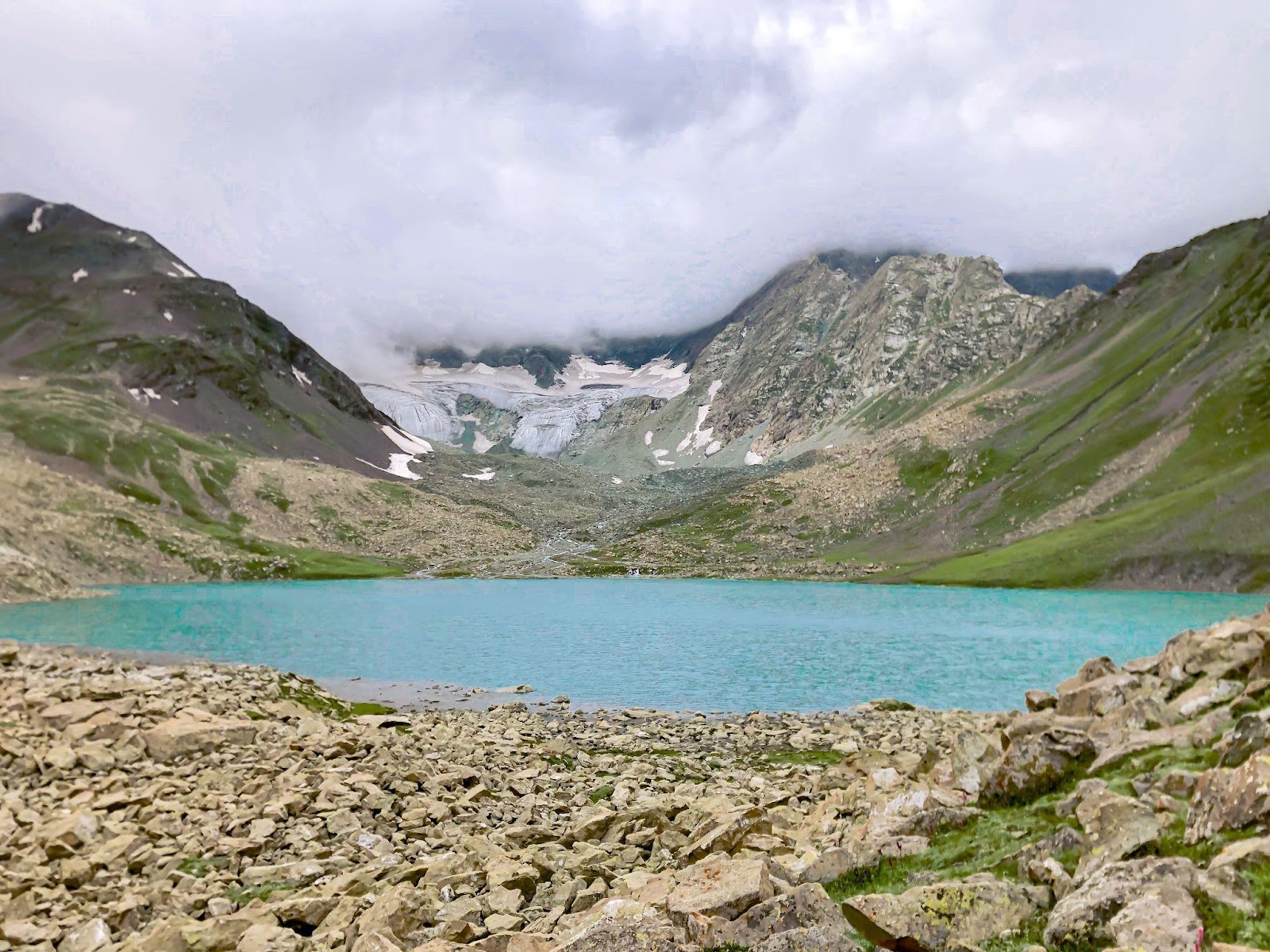
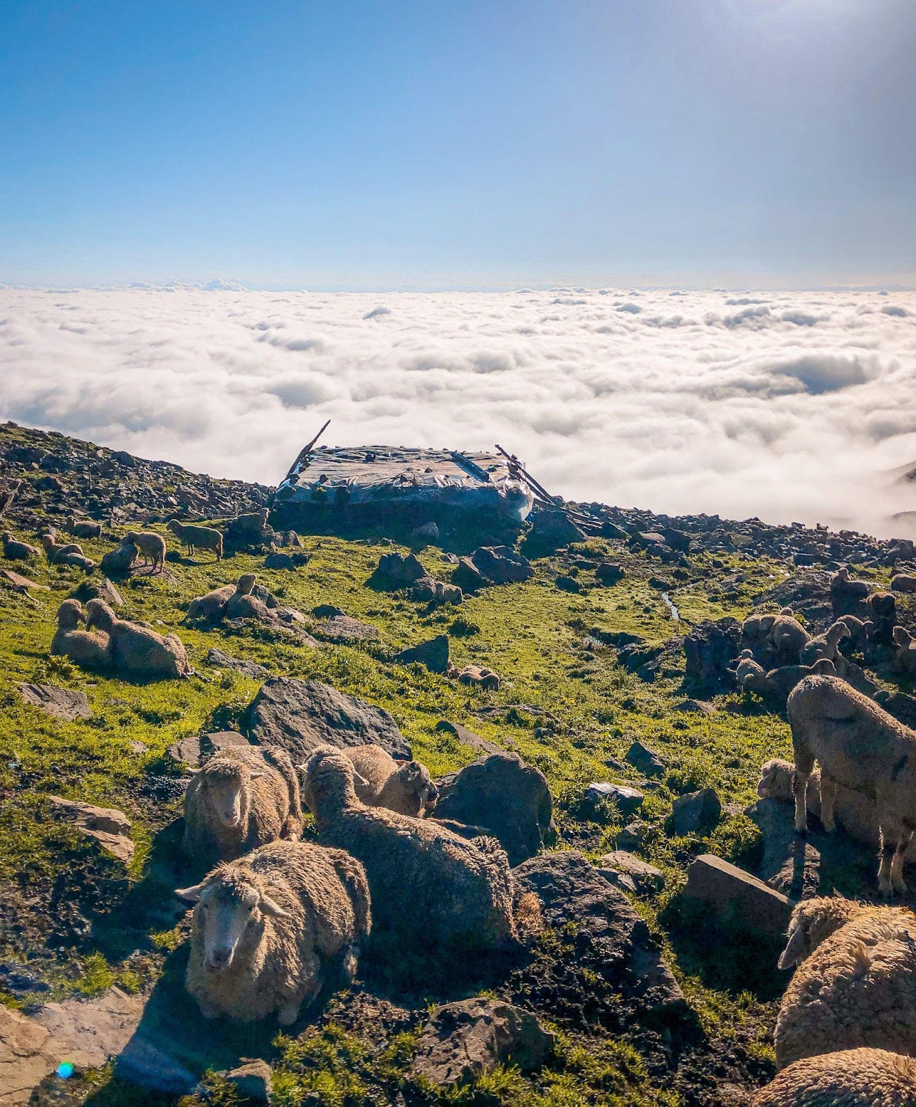
Bramsar and Chirsar lie at an elevation of 3600m and 3500m respectively at the northern foothills of the snow capped group of five summits of Brama Sakli group. The weather had still not cleared up, and coupled with painfully low visibility, I decided not to push myself to reach Mahi Nag and set up a camp with a new group of shepherds at Astanmarg. Their hospitality and generosity in sharing their time and food left me in awe and will forever remain one of my best memories.

Mang nar valley
Bramsar lake
Our camp was on the spur of Pir Panjal overlooking the vale. By evening, the weather cleared up and I woke up to an unbelievably magnificent view the next morning. The entire valley of Kashmir was covered under clouds, and the sun was shining bright above it. These were the best four hours of my time in the mountains to date.
Clouds covering the valley as seen from campsite at Astanmarg
I left the camp at 8 am and moved towards Indersar lake and descended down to Mahinag via a steep gully with an elevation drop of 1000m. Due to the security reasons I had to change my plan and I continued walking up to Aharbal, which is located in district Kulgam and concluded my traverse there. It was a 4 day long journey covering a distance of around 80kms, explored the higher ridges of the range
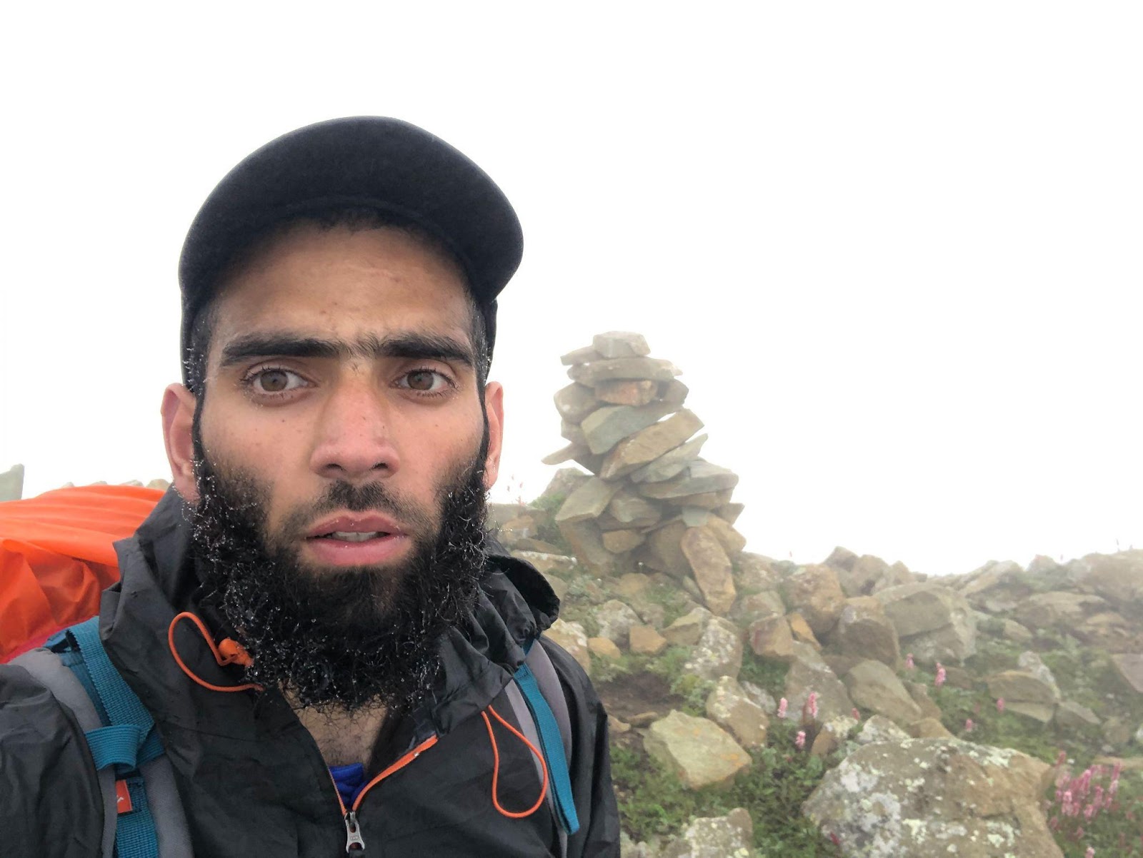
Myself at summit of 3882m peak near Astanmarg
I have mapped the route is OSM and link is : https://hiking.waymarkedtrails.org/#route?id=14681822&type=relation&map=12.0/33.5533/74.9175

🙌 Amazing
ReplyDeleteAmazingly Awesome Traverse! 😍
ReplyDeleteLooking forward for more amazing and inspiring blogs along with your amazing content on instagram
ReplyDeleteZINDABAD