Gurwan Sar Lakes ---Pir Panjal Range
Exploring Pir Panjal Range
Pir Panjal is a name of the basaltic mountain range with which the Vale of Kashmir is encompassed. It is the largest range of all lesser Himalayan ranges and bounding Kashmir from south. For trekkers in summer and for skiers during the late
winter and spring, the Pir Panjal range is a paradise. It is known for its verdant landscapes, upland pastures, high altitude alpine lakes and lofty summits. It separates the valley from the plains of Punjab and a wide range of passes over its crest connects valley with other places.
Gurwan Sar I
3rd July 2022 | Sunday
Doodhpathri is a tourist destination at an elevation of 2700m on the lower slopes of Pir Panjal Range and is about 50kms from Srinagar. I along with my team ALPINE ADVENTURERS started our hike from Doodhpathri at about 7am in the morning. The trail first leads through the forest with a gradual ascent and then through a steep scree gully towards the top of the ridge(3350m) that surrounds Doodhpathri from west. Top of the hill offers a wide panoramic view of the Doodhpathri and the Kashmir valley.
Climbing up the steep scree gully
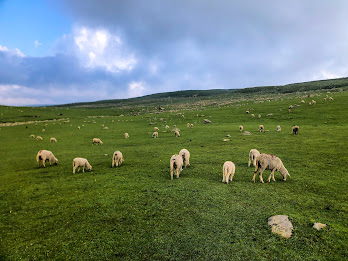
Sheep grazing at Chhanz
From Chhanz, the trail has a gradual incline all the way upto the first lake of Gurwan sar and was surrounded with many alpine flowers like Bistorta affinis, Aster and from the family of Ranunculaceae.
At 12:00 in the noon, we reached at the first lake (3900m) and i took a quick dip in it while rest of team reached. The lake was changing colours with sunlight and after spending some 15min there we left for the 2nd lake that lies SE of the first one behind the 4000m ridge at the foot of the Khari Lab peak. The slope on the other side was full of big boulders and we traversed over them towards the lake. It is a sad reality that this lake was a glacier water body some 100 years back but with increasing temperature of the globe, it has now become alpine lake fed by the small snow patches.
Here i decided with my team-mates that rather than going back to 2nd lake, we will take another route towards lake 3 via a 4050m unknown pass. They all agreed and we made a steep ascent through the moraine section, sometimes we need to jump from boulder to boulder. At 2:30pm we were at the last Gurwan sar lake just below the Nurpur Gali, which connects the Kashmir with Loran Poonch. It lies at an elevation of 4000m and is about 0.5km in length. There is small grassy area near this lake where we had our lunch. We can aslo see the pyramid shaped peak of Nurpur Neza and Nurpur gali from that spot.
Gurwan Sar III
Nurpur Neza & Gurwan sar
From the pass i also got a top view of Pamsar lake which is a part of Greater lakes Tosamaidan. It was an achievement to explore the all 3 Gurwansar lakes and Pamsar lake as well. We then started descending down to base and at around sunset, we reached back to Doodhpathri.
Starting & End point : Doodhpathri Budgam
Distance:33.7 kms
Elevation Gain: 2365m
Total time :13 hours
Max Alt: 4227m
Some more pictures:


Comments
Post a Comment