Posts

Mamneth circuit trail guide.

Image
Mamneth Meadow trek is  the perfect way to explore the natural beauty of Srinagar in a short amount of time. The trek starts from Dara Harwan which is about 14kms North of Srinagar. The trek promises to be a rejuvenating experience that will leave you refreshed and invigorated. The  meadow offers stunning panoramic views of the surrounding mountains and the valley. The normal route is about 4 km and is very beginner friendly but the trail to this meadow that I am going to discuss here is quite uncommon among hikers and is mostly known by forest officials and Bakerwals/Gujjars who during summer time stay with their herds at this place.  Elevation profile of the route using CalTopo terrain analysis Route details: The starting point is the same as the normal route but after reaching the top of the spur where the conventional route climbs directly up, you have to take the trail that goes towards the right. This trail will traverse the slopes and eventually enters into dense ...

Guide to Alpine lakes of Pir Panjal Range

Image
  Pir Panjal Range The Pir Panjal Range runs through the Kashmir valley and separates it from the rest of the Indian subcontinent. This range is known for its lush green meadows, alpine lakes, dense forests, and snow-capped peaks. The Pir Panjal range is easily accessible and offers a variety of activities such as trekking, skiing, and camping. Alpine lakes are a unique feature of the mountainous regions around the world. They are often found in areas where glaciers formed thousands of years ago and have since melted, leaving behind small, pristine lakes that are surrounded by stunning scenery. These lakes are often referred to as "jewels of the mountains" due to their clear waters, amazing colors, and breathtaking views. One of the unique features of alpine lakes is their stunning colors. These colors are due to the presence of natural minerals and organic matter in the water. The location of alpine lakes is usually at high elevations, often above the tree line. They are usu...

Mt Harmukh and the Discovery of K2

Image
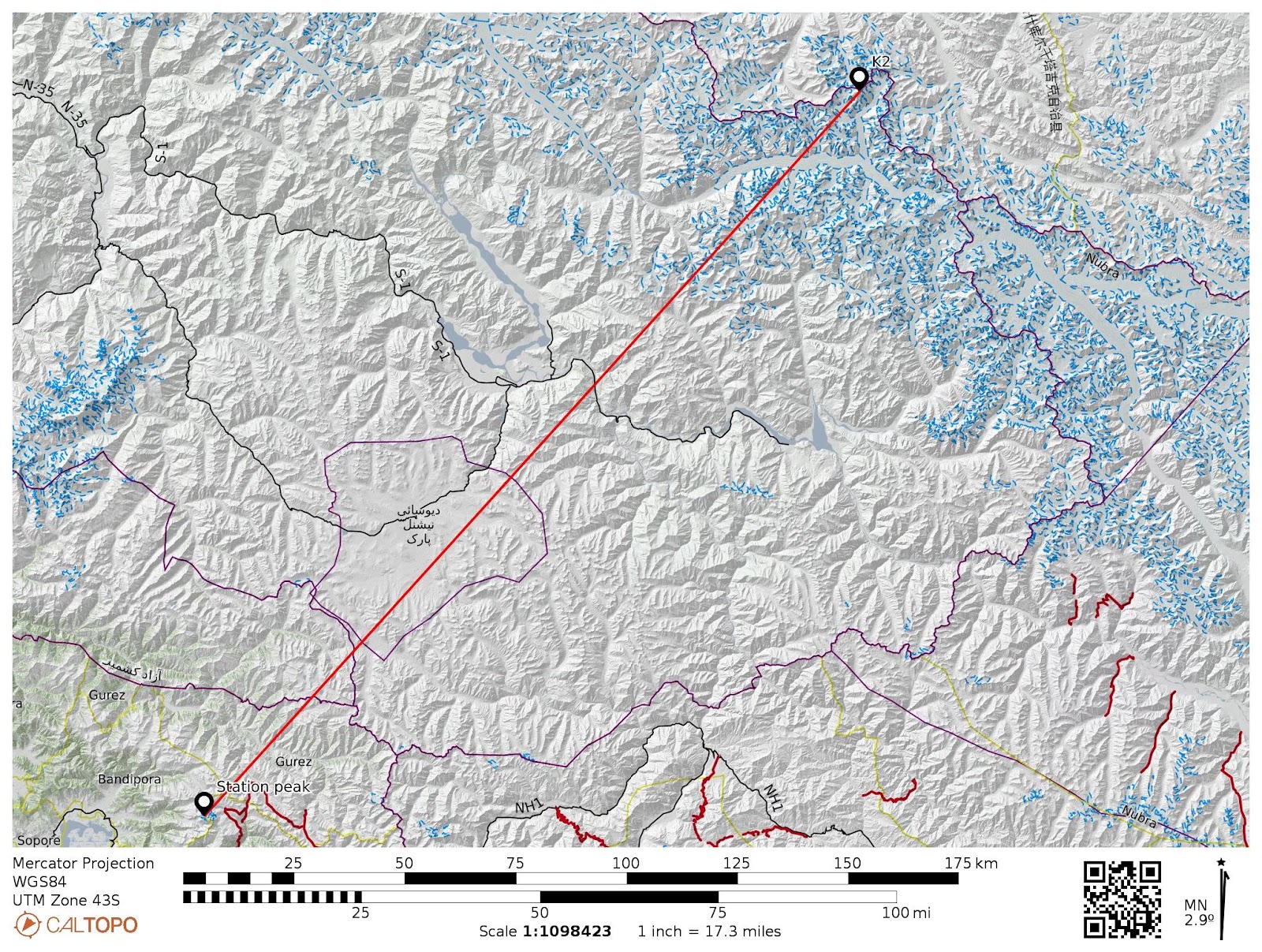
 DISCOVERY OF K2-8611M Mt. Haramukh A mountain mass towering up above the Walur lake on the NE side of Valley, lying almost due North of Srinagar . It is the most striking mountain mass rising like a giant above the ranges. The lowest of the peaks is a conical mass of rock, which was used for Survey purposes and is known as the "Station Peak (4877m)," and can be fairly easily approached from the west by a long rocky ridge. The other summits are the Western, Middle, Northern(4961m), and Eastern(5142m). The last, which is the highest of all, is separated by a gap, 400 feet deep, from the rest of the mountain. On three sides-namely, the north, east, south-there is a deep snow cornice, resting on a sheer rock precipice that drops about 3000 feet to the upper edge of the Gangabal glaciers. Discovery of K2, the world's second-highest mountain After the defeat of Sikhs in 1846, there was a call for triangulation to be carried out into Punjab to control military and revenue surve...

Astanmandu Baihk and Hiramarg trek

Image
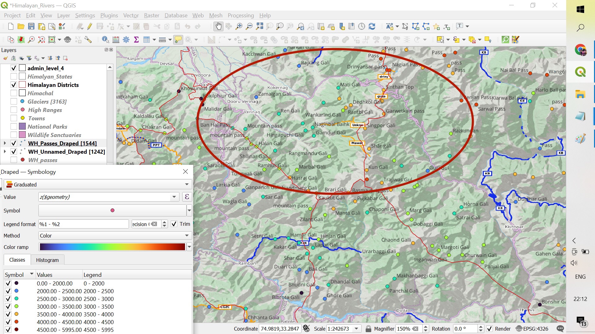
Exploring SE Extremity of Valley By the SE extremity, i mean the area between Banihal range from Doru Verinag upto Sinthan pass. There is so much of  potential in this sub 3500m  regions of Kokernag, Daksum, Garol, Doru Verinag and surrounding regions. These regions are separated by the long spurs of main mountain range surrounding the valley from SE. Map showing the surrounding hills and passes. Sunday, 08-01-2023 As usual, we left our homes early in the morning towards the hamlet of Matti in the Kokernag tehsil of Anantnag district. The hamlet is at an elevation of 2200m and we started our hike towards Hiramarg Baihk which was at an elevation of 3300m. The ascent was inclined from the starting  and the route winding through the dense forests mainly ...